Vietnamese, American and French scientists (including UMR LEGOS) have set up and exploited a model capable of explaining the mechanisms that govern the circulation of water passing through the South China Sea, an obligatory passage between the Pacific Ocean and the Indian Ocean. Their results are published in the journal Geoscientific Model Development.
Two oceans, six straits… The South China Sea combines the complexity factors acting on the circulation of water. SYMPHONIE, an ocean model, finally allows us to understand the mechanisms at work in this area.
A complex ocean crossroads
“The surface waters of the global ocean circulation which participate in the functioning of the climate transit between the Pacific and Indian Oceans through the South China Sea in Southeast Asia”. Having thus set the scene, Marine Herrmann, oceanographer at LEGOS, continues: during their crossing, these waters are subject to numerous influencing factors: heat and fresh water inputs, mixing induced by the tide, eddies, etc. . They emerge transformed, softened and warmed, and then continue their journey in the global ocean. Due to their interactions with the continent and the atmosphere, the study and quantification of water, salt and heat balances in the area is essential for understanding the climate on both a regional and global scale. The topographical complexity of the region – this flow from one ocean to the other taking place via six straits – however makes the simultaneous in situ instrumentation of all the straits impractical.
Modeling water circulation mechanisms
Used in a complementary manner with available observations, modeling proves to be a tool of choice to resolve this challenge, provided it is capable of representing the different mechanisms involved in the transport and transformation of water masses. Researchers from LEGOS, Hanoi University of Science and Technology (USTH, Vietnam) and Oregon State University (OSU, USA) therefore used high-resolution modeling to better take into account, understand and quantify the role of these mechanisms. Developed by the SIROCCO National Observation Service, the SYMPHONIE ocean model provides an explicit representation of the tide as well as an online calculation module for the incoming and outgoing balances of the different elements. Compared to other products, the simulation carried out over the period 2009-2018 proved the added value of the model.
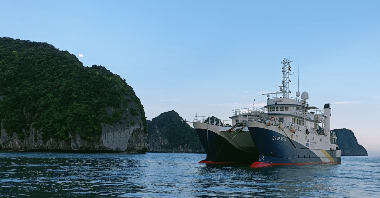
Measurement campaign on the plume of the Red River (with shellfish farmers’ cabins) illustrative of the “open” ocean.

Assessment of water masses under the influence of monsoons
The volumes of water in motion are impressive: on an annual scale the water supply represents around 4 million m3/s, or 20 times the flow of the Amazon! Modeling shows that this supply comes almost exclusively from seawater arriving from the Pacific Ocean, via the Luzon Strait (95%) and the Balabac Strait (2%). To these salty waters is added a small quantity (3%) of fresh water brought by rains and rivers. This last volume, which seems negligible in the face of the considerable masses of water involved, still represents a contribution of one meter per year to the entire area. To keep sea levels generally stable, this fresh water is evacuated through the straits. The simulation provides an estimate of the percentages of outflows through three straits: a quarter of this water flows north through the Taiwan Strait towards the East China Sea, the remaining three quarters flows south towards the Indian Ocean through the Mindoro and Karimata Straits. The modeling also reveals seasonality in the observed flows. “The annual cycle of these salt and fresh water flows is mainly driven by the monsoon regime,” explains Ngoc Trinh Bich, who defended her thesis on this subject before becoming a researcher at USTH. During the winter monsoon, dry northeasterly winds favor the entry of water through the Luzon Strait and evaporation to the ocean surface, while the humid southwesterly winds of the summer monsoon favor precipitation and the exit of water through the Taiwan Strait. Used in complementarity with measurements at sea, in particular those carried out during the Franco-Vietnamese PLUME campaign in May 2024 aboard the Antea off the Vietnamese coast, this study opens the way towards a better understanding of the ocean dynamics of this regional system as well as its influence on marine ecosystems, the propagation of contaminants, or even interaction with the atmosphere.