The High Seas Protection Treaty (BBNJ) entered into force on January 17, triggering the organization of a Conference of the Parties (COP) on the Ocean. A preparatory meeting is being held in New York starting March 23. This universal agreement allows for the creation of marine protected areas in international waters, similar to those already existing in the waters of many countries. This is the case in the Galapagos Islands (Ecuador). How are these areas monitored? A joint interview with two specialists.
Protecting 30% of the world’s oceans: this is the goal nations have set for themselves in order to halt the very serious loss of biodiversity caused by human activities that our planet is facing. To achieve this, it will be essential to create marine protected areas in the high seas, that part of international waters which covers 50% of the planet and constitutes a common good.
Within these reserves, birds, turtles, fish and marine mammals will be able to migrate, feed and reproduce safely, ensuring the survival of the entire food chain and fisheries resources for humans.
This is the key measure of the High Seas Treaty (BBNJ), an international pact that entered into force last January and whose implementation will be ensured by the Ocean COPs. The first COP will be held in New York in late 2026 or early 2027. A preparatory meeting is taking place on March 23.
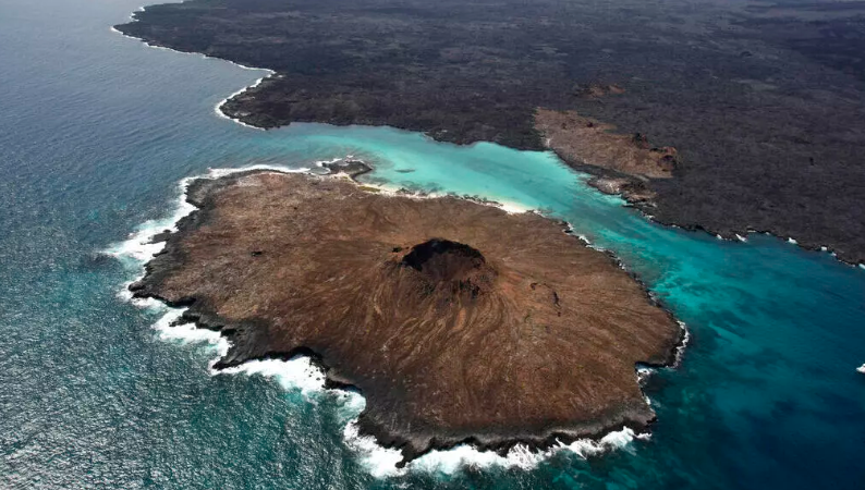
In Latin America, one of the most emblematic reserves is the Galápagos Islands, a refuge for endangered species , which has been recognized as a biosphere reserve for its exceptional contribution to ecosystem conservation and scientific research. In October 2025, the Hermandad Reserve, covering 60,000 km², was added to this biosphere reserve to create a true migratory corridor between the protected waters of Costa Rica and those of Ecuador.
Susana Cárdenas, professor and director of the Institute of Ecology at the University of San Francisco de Quito and co-chair of the Galápagos Life Fund, which channels resources to this reserve, and Diana Vinueza, project manager for the Wildaid Foundation in the Galápagos, a specialist in monitoring marine protected areas.
RFI: Why was the decision made to expand the Galapagos reserve in 2022? What is the ecological value of this new reserve?
Susana Cárdenas : Scientific data is extremely important in this regard. In the Pacific, there are significant but isolated marine protected areas. One of the main questions that conservation efforts had to focus on was therefore the connectivity of protected areas: was it possible to expand the Galapagos Marine Reserve so that it would have conservation objectives and connectivity with important areas, for example, the Cocos Island Protected Area in Costa Rica? There is already scientific evidence showing that threatened migratory species use these corridors, particularly between the Galapagos and Cocos Island, as migration routes. But they were not protected. Examples include hammerhead sharks, which are critically endangered according to the IUCN Red List, sea turtles, and several whale species. This is the main reason why the Hermandad Marine Reserve was created: a reserve that connects with the Bicentenario area of Cocos Island, by Costa Rica, which was also created at the same time as the Hermandad Reserve, in Ecuador.
There are different levels of protection: even in some marine protected areas, fishing is permitted, sometimes using very aggressive techniques such as trawling or longlining. What is allowed and what is prohibited in the Hermandad reserve?
SC: The Hermandad Marine Reserve offers 60,000 km² of protection. This means that no extractive activity, whether artisanal or industrial, can take place here. In addition, there are two buffer zones at the extremities, totaling an extra 30,000 km² of protection, where only industrial purse seine fishing is permitted because it results in less bycatch than longline fishing.
Accidental catches?
SC: Bycatch occurs precisely when we use fishing gear that catches, in addition to target species such as tuna, other non-target species: sharks, seabirds, sea turtles. Longlines are fishing lines with thousands of hooks. And this has the effect of increasing the mortality of threatened and endangered species.
And to prevent these protected areas from becoming mere « paper reserves, » existing only in theory, it’s essential to have a naval force capable of intercepting boats engaged in illegal fishing, for example. Diana Vinueza, please explain how the software you use to monitor marine activity works; this software will support the Ecuadorian naval forces…
Diana Vinueza: We spent a long time searching for the most effective platform to monitor these fishing activities, and we found the Themis platform, from a French company [CLS, based in Toulouse, editor’s note], which we have been using for almost eight years to monitor both the Galapagos Marine Reserve and the Hermandad Marine Reserve. This platform displays maps on a screen that allow us to see all the collaborative vessels sailing in the marine reserve. Collaborative means that these vessels are equipped with VMS (Vessel Monitoring System) and AIS (Automatic Identification System) tracking systems, which allow the authorities to track them remotely. The Ecuadorian fishing fleet must use these systems to be monitored by the relevant authority.
What does this tool look like?
DV: This is a dynamic map that can be viewed on screen and which allows us to observe the maritime traffic that crosses our exclusive economic zone.
Do you ever detect, for example, suspicious vessels or vessels engaged in activities they should not be carrying out, such as trawling?
DV: Yes, the platform allows us to observe vessel behavior, for example, in industrial fishing, such as purse seine fishing. A vessel’s average cruising speed is eight knots. But when it reaches fishing speed, it cuts its engines because it drifts to perform the fishing maneuver. The platform helps observe this type of behavior. It also sends alarms if a vessel enters an area where it is not authorized to be, which allows you to gather intelligence to detect any illegal activity, such as illegal fishing in the Hermandad Marine Reserve or the Galapagos Marine Reserve.
Are there sometimes cases of boarding or, overall, do ships respect the prohibitions in force ?
DV: In 2010, when we began implementing satellite surveillance technology in the country and in the Galapagos Marine Reserve, that was the year we recorded the highest number of boardings and captures of fishing vessels engaged in illegal activities. Since 2010, logically, as they know there is now an authority, these activities have decreased significantly.
It must also be said that the country’s law, which was improved in 2015, has helped us a great deal. If a boat enters the Galapagos Marine Reserve, it is fined $300, $5,000, or $10,000 for entering a protected area where it should not be conducting activities without justification.
Satellite monitoring platforms are therefore essential for ensuring people comply with the rules, but also for enforcement. We work in the same way for the Hermandad reserve.
Can fishing boats cross the Hermandad reserve?
DV: Yes, Hermandad is located in an exclusive economic zone; it’s in the Galapagos Islands region. We are signatories to the UN Convention on the Law of the Sea. We must grant the right of » innocent passage » to all ships transiting the exclusive economic zone.
It’s not just about protecting ecosystems. Protecting the water also benefits fishing itself. It allows fish stocks to regenerate, and there’s what’s known as a « spillover effect, » meaning that fish stocks also increase in areas near marine reserves. This phenomenon has been observed in the Mediterranean for lobsters and in the Atlantic for cod. Has a similar phenomenon occurred in the waters surrounding the Galapagos reserve?
DV: It has been proven that, thanks to the creation of this protected area in the Galapagos, fishing has been maintained in Ecuador, for example, tuna fishing. This is the « spillover effect » that the protected area generates on the Hermandad Marine Reserve. It has allowed this area to maintain high fishing productivity. Fishing activity is concentrated in an area called the western Galapagos Islands, but outside the protected area. They are there truly because of everything that the Galapagos Islands do. Marine protected areas benefit fishermen and guarantee food security for all the peoples of the planet. What Ecuador catches with its tuna fleet is destined for the whole world.
source : RFI