Predicting the drift and dispersion of marine pollutants such as hydrocarbons and plastics, as well as living organisms such as phytoplankton or fish larvae, is essential for the sustainable management of coastal zones in the context of preserving marine ecosystems. In 2015, it was estimated that between 4.8 and 12.7 million tonnes of land waste ends up in the oceans each year, figures set to increase.
On a large scale, the phenomena of transport and accumulation of floating marine waste are more or less known, such as the accumulation of waste on the 7th continent in the northern Pacific Ocean, for example. However, at finer scales, less than 10 kilometers, the presence of numerous eddies, zones of convergence, where marine currents come together, and divergence, where marine currents separate, on the surface of the oceans complicates the understanding of the drift of floating materials.
The south-eastern Bay of Biscay, like many other coastal areas around the world, faces several environmental problems. These include pollution near urban and industrial areas such as Bilbao and San Sebastian, toxic algae blooms, loss of biodiversity and the proliferation of invasive species. Additionally, the region has been identified as an area of marine litter accumulation by regional ocean models.
Locate waste accumulation areas
As part of my thesis and a Spanish national project called LAMARCA, I am trying to understand and locate the accumulation zones of floating marine waste in the south-east of the Bay of Biscay.
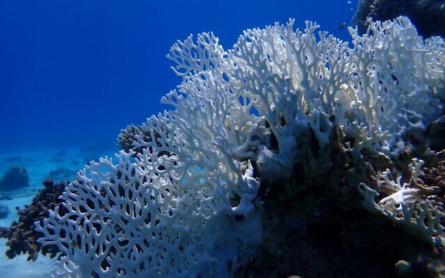
In the Bay of Biscay, and in semi-enclosed seas in general (bodies of water partially surrounded by land, but which are connected to the ocean such as the Mediterranean or the Baltic Sea), structures of convergence of currents accumulating Marine debris is frequently observed, even with the naked eye. A study carried out by Irene Ruiz, researcher at AZTI, highlighted the fact that these structures are generally around 1 kilometer long and accumulate on average 78 kilograms of floating marine waste.
Convergence structure of currents accumulating foam and marine debris taken during the April 2022 oceanography campaign. Provided by the author
Activities linked to fishing, maritime transport and aquaculture are responsible for 35% of the waste analyzed during this study, and plastic turns out to be the predominant material. The remaining 65% comes from terrestrial sources.
To understand and locate areas where floating marine waste accumulates, I rely on diagnostics estimated from surface current speed measurements by oceanographic radars. These diagnostics allow me to locate and follow the evolution of convergent structures of coastal ocean circulation. A convergent structure in a flow is an area where ocean currents come together, causing the volumes of water and the materials they carry to come together. The objective of my study is to understand how these structures govern the spatial and temporal distribution of materials transported by currents.
Radars to follow currents
Radar technology is used in many contexts such as meteorology, air, road or maritime transport. The word RADAR stands for “Radio Detection and Ranging”. This technology uses electromagnetic waves to detect and track the distance and speed of different objects. Numerous radar stations installed on our coasts allow continuous observations of currents with a range of up to 200 kilometers. Radars measure the speed and direction of ocean currents by detecting the Doppler shift (frequency shift) of radio waves reflected from sea surface waves. Based on the radial measurements, surface current maps are generated with a temporal resolution of 1 hour and a spatial resolution of 2.5 km, which means that the system is capable of capturing ocean structures of 2.5 km and more.
Photo of a radar station in the Bay of Biscay. Provided by the author
I use these maps to calculate Lyapunov exponents, a mathematical quantity used to estimate the convergence of marine currents at the ocean surface. Maps of Lyapunov exponents indicate regions of the ocean where the trajectories of floating particles tend to converge quickly or slowly as a function of time. This is crucial for understanding the drift of floating materials such as plastic debris or planktonic organisms. The calculation of Lyapunov exponents makes it possible to reduce the spatial resolution compared to the surface current maps from which they are calculated and to achieve, in our case, a resolution of 400 meters.
High values of Lyapunov exponents (shown in yellow above) identify areas where the convergence of surface currents detected by radars is significant. These high value lines represent the real transport barriers that drifting materials have difficulty crossing. In a coastal environment, these high values are generally organized in filaments parallel to the coast.
The results of my research align with theory and reveal the presence of lines characterized by maximum values of Lyapunov exponents, parallel to each other and parallel to the French and Spanish coasts. These convergence structures persist over time and tend to move in the dominant direction of marine currents, i.e. towards the northeast during the period covered by the study. In addition, the plume of the Adour, a major river in the studied region, is distinguished by significant convergence, being delimited by filaments presenting high values of Lyapunov exponents.
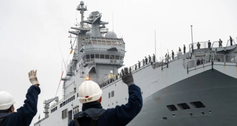
During the month of April 2022, an oceanographic campaign was carried out in the south-east of the Bay of Biscay. This campaign consisted of the deployment of drifting buoys to which was attached a floating anchor positioned at a depth of 1 meter, thus allowing the buoys to follow surface currents without being affected by the wind. The current convergence structures highlighted by the Lyapunov exponent maps coincide with an area where several buoys, initially spaced 18 kilometers apart, converged to find themselves only 1 kilometer apart at the end of the cruise .
These results represent a significant advance in techniques for detecting convergence structures from the speed of remotely sensed surface currents and have direct applications for the study of the transport and aggregation of marine litter, among others. This knowledge is essential in physical oceanography, because marine debris serves as tracers to understand ocean circulation. Conversely, our understanding of ocean currents plays an important role in determining the trajectories of floating marine debris. This facilitates the fight against pollution, which is particularly important in a society dependent on the coasts.
Source: The conversation