SHOM, the French national service for hydrography and oceanography, provides physical knowledge of the ocean. Its internationally recognized expertise, products, and services support the needs of the armed forces, ensure the safety of navigators, guide public maritime and coastal policies, support the development of the blue economy, and contribute to the preservation of the marine environment. Thierry Schmitt, Deputy Head of the Bathymetry Department (which measures ocean depth and seafloor topography), sheds light on the mission, activities, and current challenges of the organization. Interview.
What is SHOM’s role in ocean knowledge?
SHOM measures, describes, and anticipates the evolution of the marine environment. It documents various physical fields such as sea levels, currents, marine sediments, waves, sea temperature, salinity, underwater noise, seafloor topography, magnetic fields—both in the deep ocean and along the coasts. Bathymetry, in particular, involves measuring the depth of the oceans and mapping their topography. This science is crucial for safe navigation, scientific research, and the development of the blue economy.
How is bathymetric data collected?
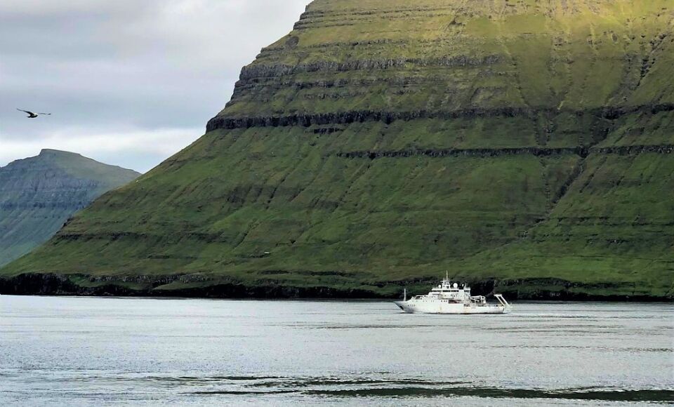
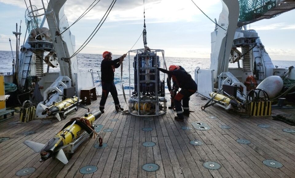
It is mainly collected using acoustic sounders installed on hydrographic and oceanographic vessels. These instruments emit acoustic beams that reflect off the seabed, allowing depth to be measured. The set of beams forms a swath of bathymetric measurements beneath the vessel, typically spanning five to seven times the water depth. With around 15 sounders operating in French waters, we aim to produce the most accurate seabed maps possible.
France’s exclusive economic zone spans approximately 11 million square kilometers, making it the second largest in the world after that of the United States. Systematic mapping efforts are considerable, especially given the operational challenges (team deployment at sea, advanced scientific equipment, etc.), often under demanding maritime conditions. Satellite sensors can help cover larger areas more quickly, though with lower precision. In the future, marine robotics—such as surface drones or submersibles—will further enhance our exploration capacity.
What is the purpose of the data collected by SHOM?
These data primarily ensure maritime safety by supporting the reliability of nautical charts used by all navigators, both civilian and military. This is one of SHOM’s core missions. The data also allow for modeling of currents and waves, aiding oceanographic forecasting, coastal protection, and climate change adaptation.
Scientifically, they contribute to understanding geological phenomena (like plate tectonics, submarine volcanism, and dune movement) and ocean dynamics, and are also used to model natural hazards. They help identify marine habitats and explain why certain species concentrate in specific areas—crucial for defining marine protected areas and guiding marine conservation policies.
Finally, they play a strategic defense role: the French Navy relies on these data to navigate and operate safely, including in sensitive contexts.
Is SHOM involved in international initiatives?
Yes, very actively. SHOM and France are particularly proactive in bathymetry issues at the European level. We coordinate the EMODnet Bathymetry project, which aims to gather, harmonize, and disseminate bathymetric data produced by all European countries. The goal is to build a coherent, reliable, high-resolution database to better describe the European seabed.
These data are then shared with the Seabed 2030 project—an international initiative launched by GEBCO and the Nippon Foundation, supported by the International Hydrographic Organization (IHO) and the Intergovernmental Oceanographic Commission of UNESCO. Its ambitious objective: to map 100% of the ocean floor by 2030, at a minimum resolution of 500 meters. Since the project’s launch in 2017, global ocean mapping has increased from 6% to 25% based on current standards.
SHOM is fully engaged in this initiative. We believe in data sharing, as well as in sharing knowledge and expertise. This means working as a network, making data interoperable, and merging them at different scales so they can be effectively used.
This international cooperation not only enables us to advance collective knowledge of the seafloor, but also to strengthen inter-institutional ties and share best practices.

What are SHOM’s main challenges for the future?
Following the UN Ocean Conference in Nice and the adoption of an ambitious European Ocean Pact, hydrography is emerging as a central pillar of future maritime policies. For a maritime space as vast as France’s, reliable data is essential for informed decision-making.
To accelerate understanding and meet these new challenges, SHOM is innovating by modernizing its fleet and its data collection and processing systems—particularly through the use of drones and artificial intelligence. The goal is to integrate these new tools into operational practices, to combine them with existing systems, and to fully exploit their potential to improve data acquisition and reliability. This evolution is vital to face the enormity of areas still to be mapped, and to address growing needs related to security, the environment, and ocean knowledge.
Source: banquepopulaire