
Researchers have recently developed an artificial intelligence capable of reconstructing, from satellite images, high-resolution ocean currents hitherto impossible to observe. This advance could be of great help to better understand how the oceans work and anticipate extreme weather events.
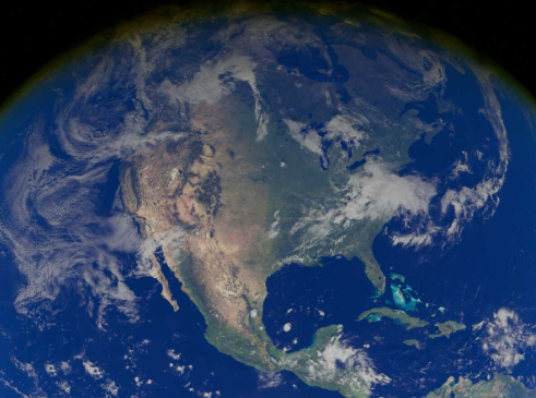
An artificial intelligence system that provides valuable help to scientists. It’s no secret: the Earth is covered with more than 70% water, a feature that has earned it the nickname « Blue Planet ». However, this essential resource for life exists in many forms. The vast majority corresponds to salt water, which represents nearly 97% of the water on the planet and is mainly found in the oceans and seas.
Conversely, fresh water represents only about 3% of this resource and is distributed among glaciers, water tables, lakes and rivers. A recent study published in the journal Nature Geoscience was interested in rapid currents present in particular in the oceans, movements that may seem invisible from space, but which nevertheless play a major role in the regulation of the Earth’s climate.
This work has allowed an important advance by offering researchers the opportunity to observe these phenomena with unprecedented precision. Indeed, they have developed GOFLOW, an AI system capable of reconstructing high-resolution ocean currents directly from satellite images. This allows them to study the small-scale ocean dynamics that influence meteorology, climate change and heat and gas exchange between the ocean and the atmosphere.
An AI system that reveals previously inaccessible data
The oceans play a major role in regulating the Earth’s climate. They transport immense amounts of heat, carbon and energy around the globe. Yet a large part of these essential processes take place on scales of a few tens of kilometers, or even less, making them almost impossible to observe with current technologies.
« The ocean is one of the most important elements of the Earth’s climate system, yet many of the processes that govern it occur at spatial and temporal scales that are extremely difficult to measure directly, » explained Roy Barkan, professor, oceanographer physicist and fluid dynamics specialist at Tel Aviv University. To try to overcome this limit, researchers have developed an artificial intelligence system capable of analyzing infrared satellite image sequences by capturing sea surface temperatures in order to reconstruct the horizontal movements of ocean waters.
This technology also makes it possible to identify subtle and particularly complex flow patterns, hitherto impossible to detect. « Thanks to GOFLOW, we can now extract dynamic information from satellite observations that were previously inaccessible, revealing the mechanisms that govern ocean mixing, heat transport and gaseous exchanges with the atmosphere, » said the lead author of the study before continuing: « in the face of the acceleration of climate change, the ability to observe these processes on a fine scale is essential to understand the phenomenon as a whole. »
A tool that could help better anticipate extreme weather events
Thanks to this system, researchers have already been able to identify remarkably dynamic processes occurring at scales of less than 30 kilometers within the Gulf Stream. It also provides information that was previously out of reach of oceanographers, including the first direct satellite measurements of the horizontal divergence of the ocean, a key indicator of the vertical movements of water bodies. Until now, researchers could only estimate it using computer simulations or limited observations.
These now observable phenomena play an essential role in the functioning of the Earth’s climate system. The mixing of oceanic waters influences in particular the intensity of storms, the appearance of marine heat waves, the dispersion of pollutants and the ability of the oceans to absorb carbon dioxide present in the atmosphere. This is why GOFLOW could contribute to significantly improving climate models and allow scientists to make more accurate predictions of extreme weather and climate events.