A strait that is blocked, and it is all world trade that is gripping: world trade is based on dozens of strategic points. Small tour of a connected but vulnerable world.
It’s a long meeting of the United Nations Security Council. Very long even. The one on April 27, on maritime safety, lasted five hours and forty-eight minutes. However, if you had listened to it in full like me, you could have heard, at the 171st minute, Antonio Guterres speak.
Addressing directly to the representatives of the United States and Iran, the Secretary-General of the United Nations laments: « I ask the parties concerned to open the Strait of Hormuz […]. Let trade resume, let the global economy breathe.”
Three days later, Donald Trump posted on Truth Social a map (generated by artificial intelligence) of the Strait of Hormuz renamed « Trump’s Strait ». Two rooms, two atmospheres. But only one vision of the Strait of Hormuz: that of a strategic passage for the global economy.
A strait among others
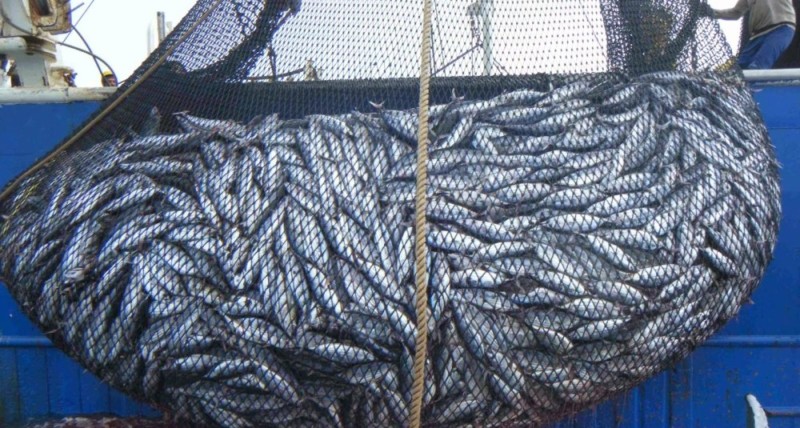
When Ormuz is blocked, 20% of the world’s oil and LNG trade remains at the doch. In a few hours, the price of a barrel soars, and your full tank of gas on the other side of the planet becomes a luxury product.
But Ormuz is only one strait among others. World trade is marked by these geographical locks. Chokes that concentrate everything: goods, military bases, communication cables… and sometimes the most explosive diplomatic tensions.
In their « Geopolitics of the Straits », published by the Cavalier Bleu in January 2025, Pauline Pic and Frédéric Lasserre list 14 straits, as all crossing points that lock world trade.
Some are familiar to us, such as Hormuz, the Bosphorus or Gibraltar, others are less known, but just as strategic, such as Macassar, Lombok or The Probe. What is striking in this list is first of all the diversity of situations. The Bosphorus Strait is only 700 meters wide in places, where the Pas-de-Calais Strait stretches for about thirty kilometers.

The Fram Strait, which separates Greenland from Svalbard, is not strategic but can still be proud of the title of « strait » when it is more than 400 kilometers wide. We must face the obvious: it is not the size that makes the strait. It’s rather the function.
Separate and connect
And this function is twofold: it is both a separation and a contact. A separation because a strait is like the door that isolates seas or oceans from each other, and a contact because it is a place that has always favored exchanges. We naturally think of maritime traffic, but the straits also concentrate large land flows as well as a high density of submarine communication cables.
The strait therefore has a double specificity since it separates as much as it connects. We also find this duality in its etymology, since the term comes from the Latin « distringere », which means both « keep away » and « tie ».
In the large family of straits, we usually include their artificial cousins that are the canals. Suez and Panama are straits made from scratch to reduce distances. But the channels always belong to someone.
The straits, on the other hand, belong to everyone since international law theoretically guarantees a right of transit to all ships. In practice, it’s a little different, as we can see at the moment with Ormuz. In January 2024, Turkey also banned access to the Bosphorus Strait to two British mine-hunting ships coming to the aid of Ukraine, citing the desire to « avoid escalation ».Advertising
Very narrow and very busy
In fact, a strait is the carambolation of two concepts that are a priori opposed: free maritime movement and the notion of territorial waters. The straits are simply too narrow for these two concepts to coexist without friction. And in addition to being very narrow, they are also very busy.
Except that not all these straits are equal, their strategic role increases with the number of ships that transit through them. So which one is the busiest in the world? In reality it is difficult to say, because it is almost impossible to have comparable data for all the straits.

Each authority or country organizes the count according to its own criteria, taking into account only ships greater than a given tonnage, or those measuring a minimum size. AIS beacons, which allow a ship to be tracked automatically via satellite, are also not of much help since a large number of boats are not required to be equipped with them.
Not to mention those for whom it is mandatory, but who decide to turn it off for more discretion. In short, to classify the straits between them, we can only rely on high and low estimates, and make them an average.
For Rotterdam, change in Malacca
To understand why these straits structure the planet, we must stop seeing the sea as a large empty space. If we look at a map of the world’s maritime routes, we realize that we should rather consider it as a network.
The overwhelming majority of ships use real maritime highways. There are lines. Points of passage. Correspondences. In fact, you have to see the ocean as a subway. And Malacca would then be the Châtelet-Les Halles of this global network.

Imagining global maritime traffic as a metro plan allows us to realize that it is a real network, with obligatory crossing points. And as with the subway, if there is a travel incident in a large station, then it is the whole network that toasts.
This whole system is extremely vulnerable. A blocked strait, and hundreds of boats are waiting to know what to do, in a world where every hour of delay is paid cash.
Traffic jams on the water
This vulnerability is mainly due to two factors. The first is the rise of maritime trade. The total number of goods transported by the sea has increased fivefold since the 1970s, from 2 billion to 11 billion metric tons. Maritime trade, which accounted for 75% of world trade in volume in 1999, now accounts for more than 90%.
But this vulnerability is also due to a logistical practice: just-in-time. The idea is to transport goods but to have no more stock, to minimize costs. We no longer store on land, the stock is on the water. Punctuality then becomes absolutely essential. Delays are very expensive and deliveries are planned months in advance. But above all, the domino effect is immediate.
In 2021, the Ever Given ran aground in the Suez Canal and blocks it for six short days. More than 400 ships were forced to wait for the reopening of the canal, and as a result: factories stopped in Germany because a component manufactured in Vietnam is missing.
Vulnerable Straits
In a world where all trade transits by the seas, having the whole system rest on obligatory crossing points that can be counted on the fingers of both hands (and one foot) seems risky. Especially since even without taking into account commercial practices, a strait is a very vulnerable space in itself.

A technical vulnerability first, linked to its width and depth, which does not allow some of these passages to accommodate all ships. A political vulnerability then, because some are located in risk areas. It’s obvious with Ormuz today, but it’s already been with Bab el-Mandeb since the early 2000s. Between 2005 and 2020, there were more than 1,000 acts of piracy at the exit of this strait, which severely disrupted traffic in the Red Sea.
Finally, an environmental vulnerability: in 2023, a drought requires restricting traffic in the Panama Canal. It goes from 38 passages per day to only 22. Faced with such an observation, we are forced to ask ourselves the question: can we bypass the straits?
Find an exit door
Faced with tensions, everyone is looking for a way out. Solutions exist, but they waste time and money. For example, like a 17th–century sailor, we can go around Africa through the Cape of Good Hope to avoid the Middle East. However, to connect, for example, Le Havre to Bombay, the Cape Route represents nearly 21,000 kilometers, compared to just over 11,000 for that of the Suez Canal.
Similarly, for a boat wishing to connect San Francisco to Liverpool, it takes 25,000 kilometers bypassing South America through the Strait of Magellan, and barely 15,000 if you pass through the Panama Canal. More days of crossing, delays, fuel expenses. In short, not the ideal.
There is another option, which is to look north. Long mythical, the Northwest and Northwest passages have now become a reality with the melting of the ice. Shanghai can now be connected to Rotterdam via the Bering Strait and the Arctic. But the crossing is more uncertain, because the ice still obstructs the road for a good part of the year.
The invincible sea
The last option remains the land bridges. In the Caucasus, the « Trump route » should create an axis between Azerbaijan and Turkey via Armenia, to offer an alternative route between Europe and Asia.
In the Emirates, China has invested billions so as not to depend only on the Strait of Hormuz, by building the Habshan-Fujaïrah pipeline, which allows it to export oil by zapping the Ormuz stage.
However, a train carries 100 containers where the largest ships carry 24,000. The sea remains invincible. We haven’t finished hearing about the straits.
source : Les echos